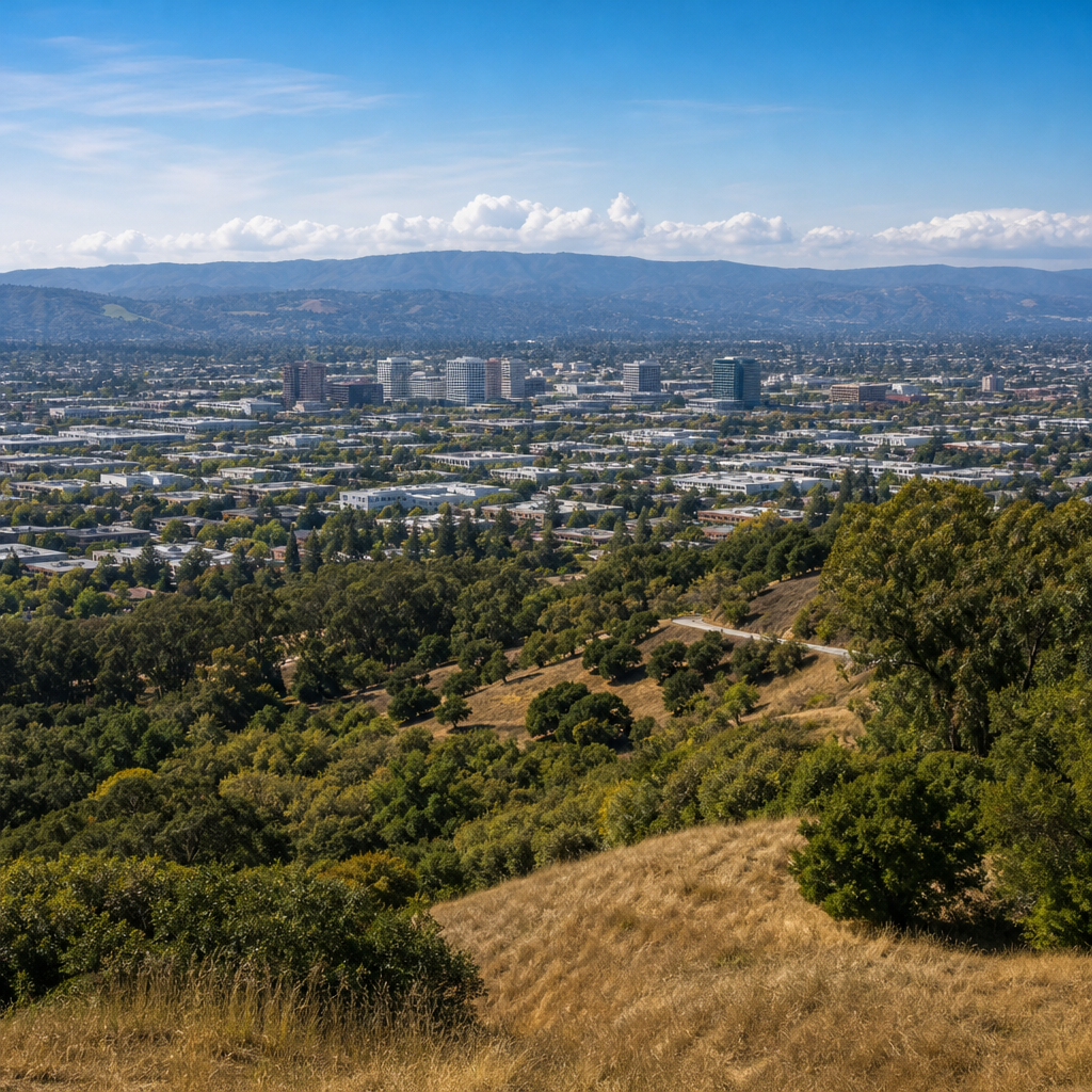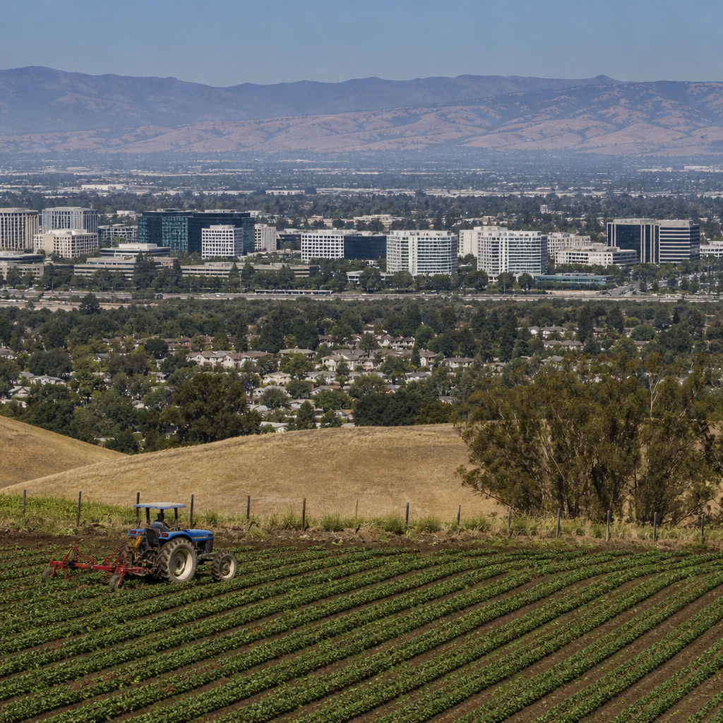
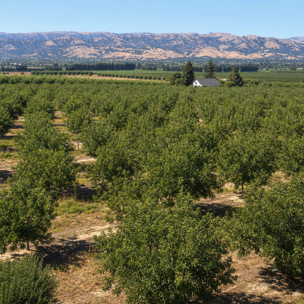
Before microchips, venture capital, and corporate campuses defined the region, Santa Clara Valley was an agricultural landscape shaped by soil, water, climate, and a long sequence of human decisions. The phrase “orchard era” refers to the period when fruit cultivation, canneries, drying yards, and farm towns dominated the valley’s economy and identity, especially from the late nineteenth century through the mid-twentieth. Understanding that era begins with geography and origins: where the valley sits, how it formed, who first lived there, why orchards thrived, and what forces transformed it into one of the most valuable urban corridors in the world. I have spent years tracing old plat maps, irrigation records, and city growth patterns, and one conclusion is consistent: Silicon Valley did not replace empty land. It replaced a highly organized agricultural system built on favorable environmental conditions and successive waves of settlement, labor, and infrastructure.
Santa Clara Valley lies at the southern end of the San Francisco Bay, bounded by the Santa Cruz Mountains to the west and the Diablo Range to the east. Those mountain systems created a broad alluvial plain, fed by creeks including the Guadalupe River, Coyote Creek, Los Gatos Creek, and Stevens Creek. Alluvial fans deposited fertile sediments over thousands of years, producing well-drained soils that proved ideal for orchards. The Mediterranean climate, with mild wet winters and warm dry summers, reduced fungal pressure during ripening and supported prunes, apricots, cherries, pears, walnuts, and peaches. Long before the name Silicon Valley existed, the area was known nationally for packed fruit and dried prunes. To understand the region’s later technology boom, readers need this foundation, because the transportation routes, land subdivision patterns, water systems, and town centers that served orchards often shaped later suburban and industrial development.
Landforms, Climate, and Why Orchards Took Hold
Santa Clara Valley’s physical geography made orchard agriculture unusually productive. The valley floor slopes gently toward the bay, and repeated flooding from mountain-fed streams laid down deep alluvium. In practical terms, that meant roots could penetrate easily, winter rains could recharge the ground, and fruit trees could establish stable yields. The region’s frost patterns also mattered. Cold air drainage off nearby foothills created microclimates, so growers learned quickly which benches suited apricots, which lower lands fit prunes, and which sheltered pockets could support more frost-sensitive crops. By the 1890s, horticulturalists and county boosters were already describing the valley as a fruit belt rather than a grain district.
Climate was only half the story; water management completed the picture. Seasonal rainfall in California is unreliable, and commercial orchards require predictable moisture at key growth stages. Early farmers used wells, diversion ditches, and local creek systems, later supplemented by reservoirs and more formalized irrigation works. The shift from extensive grain and grazing to intensive fruit culture depended on this control. Fruit trees are capital crops: growers invest years before full production, so the environmental risk profile had to be manageable. Santa Clara Valley offered enough winter chill for dormancy, enough summer heat for sugar development, and enough accessible groundwater to reduce catastrophic loss. Those conditions explain why the landscape filled with regular rows of trees instead of remaining open pasture.
Indigenous Foundations and the Spanish-Mexican Period
Any accurate account of Santa Clara Valley’s origins starts before American settlement. The valley was home to Indigenous communities, especially Ohlone-speaking peoples, who managed local environments through seasonal movement, food gathering, burning practices, and creek-based settlement patterns. Their knowledge of watercourses, oak woodlands, and wetland margins reflected a long-standing relationship with the land. The transformation of the valley began forcibly with Spanish colonization in the late eighteenth century. Mission Santa Clara de Asís, founded in 1777, became one of the institutional anchors of Spanish settlement in Alta California, alongside the pueblo at San José, established that same year as the first civilian town in the province.
The Spanish and later Mexican periods introduced cattle ranching, mission agriculture, and large land grants. Hides, tallow, grain, and livestock dominated more than fruit orchards at this stage, but the era established enduring property patterns and transportation alignments. After Mexican secularization of the missions in the 1830s, ranchos expanded under private control. These rancho boundaries did not survive intact forever, yet they influenced later subdivision and legal conflict after the United States took control following the Mexican-American War. In my review of historical parcel maps, many later roads and town edges still echo rancho-era lines. The orchard era did not emerge from nowhere; it rose atop mission lands, pueblo fields, and former ranchos that had already reorganized Indigenous landscapes.
From Wheat Fields to the Valley of Heart’s Delight
The decisive shift toward orchards came after the Gold Rush and the American annexation period. In the mid-nineteenth century, much of Santa Clara Valley supported wheat, hay, livestock, and mixed farming. Grain made sense early because it required less capital and labor than permanent tree crops. But grain profits were volatile, soils could be exhausted, and transportation improvements changed what was commercially viable. As rail links improved and urban markets expanded, growers saw greater returns in fruit. Trees yielded products that could be shipped fresh, dried, canned, or processed, giving farmers more market pathways than a wheat monoculture allowed.
By the late nineteenth and early twentieth centuries, Santa Clara Valley had become famous as the “Valley of Heart’s Delight.” That phrase was not just booster poetry. It described an economically coherent agricultural district with specialized infrastructure: nurseries, packing houses, dehydrators, canneries, cooperatives, box factories, rail sidings, and seasonal labor camps. Apricots and prunes were especially important. French prune varieties adapted well to local conditions, and dried prunes became a durable export commodity. Apricots fed both fresh markets and canning lines. Cherries thrived in selected zones, while walnuts and pears added diversity. Blossom season later became iconic, but the working landscape mattered more than the postcard image. The valley operated as an integrated fruit economy.
| Feature | Orchard Era Role | Long-Term Effect on the Region |
|---|---|---|
| Alluvial soils | Supported deep-rooted fruit trees and stable yields | Made farmland highly valuable before urbanization |
| Creeks and groundwater | Enabled irrigation and intensive horticulture | Drove later reservoir, well, and water district planning |
| Rail connections | Moved fresh, dried, and canned fruit to market | Established corridors later used by industry and suburbs |
| Town centers like San José and Santa Clara | Provided labor, finance, processing, and trade services | Became anchors for metropolitan expansion |
| Large parcels subdivided into orchards | Encouraged specialized family farming and commercial production | Created tract patterns later converted to subdivisions and campuses |
Towns, Transportation, and the Working Agricultural Landscape
Orchards did not exist in isolation. The valley’s towns formed a network that supported agricultural production and exchange. San José served as the principal commercial center, while communities such as Santa Clara, Sunnyvale, Campbell, Cupertino, Los Gatos, Mountain View, and Morgan Hill linked farms to processors and freight routes. Interurban rail and Southern Pacific lines were crucial because fruit is perishable, and timing affects price. A box of apricots delayed in heat could lose value quickly. Reliable transportation therefore shaped where orchards expanded and where packing facilities clustered.
Roads also followed agricultural logic. Many routes connected ranch boundaries, creek crossings, and shipping depots long before they served commuters. El Camino Real connected older mission and pueblo sites, while cross-valley roads tied orchards to railheads and canneries. As I compare historical aerials to present street grids, the continuity is striking: modern arterials frequently overlay farm-to-market corridors. Labor patterns were equally important. Orchard work relied on family labor, hired local workers, and migrant or immigrant labor streams that shifted by season and by crop. Picking cherries, sulfuring apricots, pruning trees, and operating cannery lines required different skills and timing. The orchard era was beautiful in memory, but it was also intensive, disciplined, and dependent on a large workforce.
Water, Risk, and the Limits of the Orchard Economy
Despite its success, the orchard system had limits. Water supply was never infinite. Intensive pumping lowered groundwater in parts of the valley, and periodic drought exposed the vulnerability of depending on local hydrology. Flooding also remained a recurring problem along major creeks. Fruit agriculture is more profitable than grain, but it is also more sensitive to pests, labor shortages, price swings, and delayed processing capacity. If a cannery could not take fruit at peak ripeness, growers lost money fast. Pest management, including control of codling moth and fungal diseases, required coordinated action, technical advice, and county-level agricultural oversight.
Urbanization pressures mounted early as well. Land near town became more valuable for subdivision, schools, roads, and industry. By the 1930s and 1940s, the valley still looked overwhelmingly agricultural in many districts, yet the ingredients of change were visible. Stanford University, regional research activity, defense production, improved highways, and wartime manufacturing all increased the strategic importance of the peninsula and South Bay. The same flat land that worked for orchards also worked for airfields, factories, and housing tracts. Once postwar growth accelerated, orchard acreage declined rapidly. Geography that once favored fruit now favored expansion.
Why Geography and Origins Still Matter Today
Modern Silicon Valley makes more sense when viewed as a second landscape built over a first one. Flood-control debates, groundwater recharge projects, annexation boundaries, and even neighborhood names often trace back to the orchard era and the older Spanish-Mexican landscape beneath it. Apricot Lane, Cherry Avenue, Rancho roads, and surviving cannery buildings are not decorative nostalgia; they are clues to how the region developed. The concentration of early wealth, transportation access, and parcel organization created a platform for later industry. Even today, planners and historians rely on orchard maps, creek studies, and land grant records to explain why some districts urbanized earlier, why others faced flood risk, and why open space survived in certain foothill areas.
Before Silicon Valley, Santa Clara Valley was a fertile, highly engineered agricultural basin whose geography made orchards profitable and whose layered history made transformation possible. Mountains framed the plain, creeks fed alluvial soils, and a Mediterranean climate favored fruit. Indigenous stewardship, Spanish colonization, Mexican ranchos, American market farming, rail transport, and water development each left a mark on the land. The orchard era matters because it explains the region’s original economic logic and many of its present-day patterns. If you want to understand Santa Clara Valley historically, start with geography and origins, then follow the roads, waterways, and old orchard parcels into every later chapter of the story. Explore the related articles in this Historical Perspectives hub to go deeper into settlement, agriculture, labor, and urban change.
Frequently Asked Questions
What did Santa Clara Valley look like before it became Silicon Valley?
Before office parks, expressways, and technology campuses reshaped the region, Santa Clara Valley was widely known for its agricultural landscape. Much of the valley floor was covered in orchards of apricots, prunes, cherries, pears, peaches, and other fruit crops, arranged in long, orderly rows that changed with the seasons. In spring, blooming trees created a striking visual identity that residents and visitors remembered for decades. In summer and fall, the landscape shifted into a working countryside filled with harvest crews, packing sheds, drying trays, warehouses, rail spurs, and canneries. Rather than a continuous urban environment, the valley consisted of small towns, farmsteads, country roads, creeks, irrigation systems, and open land between communities.
The setting was shaped by a combination of natural conditions and human use. The valley sits between mountain ranges, with fertile alluvial soils deposited over long periods by streams flowing from the surrounding hills. Its Mediterranean climate—wet winters, dry summers, abundant sunshine, and relatively mild temperatures—made it especially well suited to fruit cultivation. Water mattered enormously as well. Creeks, seasonal streams, groundwater, wells, and later organized water infrastructure all helped sustain orchards in a place where summer rainfall was limited. In other words, the orchard era was not an accident of nostalgia; it was rooted in geography, climate, and a practical agricultural economy.
Just as important, the valley’s appearance reflected a specific historical moment. The “orchard era” emerged after earlier periods of Indigenous land stewardship, Spanish and Mexican rule, mission and rancho systems, and the arrival of American settlers and commercial agriculture. By the late nineteenth and early twentieth centuries, fruit growing had become a dominant identity for the region. Towns were connected to farm production, local labor patterns followed the rhythms of planting and harvest, and industry meant food processing as much as manufacturing. So when people ask what Santa Clara Valley looked like before Silicon Valley, the most accurate answer is this: it looked like a highly productive agricultural landscape, deeply organized around orchards, seasonal work, and the business of growing, preserving, and shipping fruit.
Why was Santa Clara Valley so well suited to orchards and fruit growing?
Santa Clara Valley’s success as a fruit-growing region came from an unusually favorable mix of environmental conditions. First, the valley floor offered fertile soils that had built up over centuries through stream and river deposition. These alluvial soils supported deep root systems and were productive for a range of crops. Second, the climate was exceptionally valuable for orchard agriculture. Fruit trees benefit from seasonal rhythms, and the valley’s pattern of mild, wetter winters and long, dry, sunny summers created strong conditions for flowering, fruit set, ripening, and harvest. The relatively moderate climate also reduced some of the risks that harsher regions posed to sensitive crops.
Water availability, even in a dry-summer climate, was another key factor. While the valley did not receive much summer rain, it was crossed by creeks descending from the surrounding mountains, and early growers made increasing use of wells, pumps, irrigation methods, and groundwater. Over time, water management became central to agricultural success. The ability to combine natural fertility with increasingly organized control over irrigation made intensive fruit cultivation possible on a large scale. This was especially important for orchard crops, which require long-term investment and dependable care over multiple seasons rather than a single annual planting cycle.
There were also economic advantages to the valley’s geography. Santa Clara Valley was close to San Francisco and the Bay Area market, and as rail transportation improved, growers gained better access to regional and national distribution networks. Perishable crops could move more efficiently, and processed fruit products such as canned and dried goods could be shipped even farther. That combination—good soil, favorable climate, manageable water resources, and access to markets—helped transform the valley into one of California’s most productive fruit regions. The orchard landscape that later generations remembered fondly was built on very practical agricultural logic, not just scenic appeal.
What kinds of crops and industries defined the orchard era in Santa Clara Valley?
The orchard era was defined by more than just rows of fruit trees. It was an entire agricultural economy anchored by specific crops and the industries needed to process, preserve, package, and ship them. Among the most important crops were prunes, apricots, cherries, peaches, pears, and plums. Prunes became especially significant because dried fruit could be stored and transported efficiently, giving growers access to broader markets. Apricots and peaches were closely tied to canning operations, while cherries and other fruits served both fresh and processed markets. The valley’s agricultural identity depended on the diversity of fruit production, even though certain crops periodically dominated depending on prices, demand, and processing capacity.
Processing industries were essential to making orchard agriculture profitable at scale. Canneries turned perishable fruit into shelf-stable goods that could be sold nationwide and internationally. Drying yards and dehydrators preserved prunes, apricots, and other fruit for storage and export. Packing houses handled sorting, grading, boxing, and labeling, while rail connections allowed products to move efficiently beyond the local area. These activities created a built landscape of industrial agriculture: warehouse districts, smoke stacks, loading platforms, sheds, and work yards were just as much a part of the orchard era as the blossoms themselves.
Labor was also a defining part of this system. Orchard agriculture required pruning, irrigation, pest management, harvesting, packing, and processing, much of it seasonal and labor-intensive. Families, local workers, and migrant laborers all played roles, though the exact composition of the workforce changed over time. As a result, the orchard era shaped not only the economy but also the social life of the valley. Small towns grew around agricultural trade, harvest seasons affected community rhythms, and employment extended from the fields to the canneries. To understand the era fully, it is important to see it as a linked system: orchards in the countryside, industrial processing in town, and transportation networks tying everything together.
How did the orchard era shape everyday life and local identity in Santa Clara Valley?
The orchard era shaped everyday life at nearly every level. Work schedules often followed the agricultural calendar, with pruning and maintenance in one season, blossoming in another, and intense harvest labor during peak fruit months. In many communities, the pace of life was tied to what the orchards needed and what the canneries required. Roads carried farm wagons, trucks, and labor crews. Towns supported feed suppliers, equipment dealers, box makers, processors, and merchants serving farm families and workers. Even people who did not directly own land often depended on agriculture through related businesses or seasonal employment.
Culturally, the valley developed an identity deeply connected to fruit growing. Blossoms became part of the region’s image, and the prosperity of local communities was often measured through orchard output and cannery activity. Agricultural fairs, civic promotion, and local boosterism celebrated the valley’s fertility and productivity. Homes, schools, churches, and commercial districts existed within a landscape where agricultural success was highly visible. The orchard era also influenced patterns of settlement: many towns remained distinct rather than merging into a single continuous city, because open agricultural land separated them for long periods.
At the same time, everyday life in the orchard era was not uniformly idyllic. It involved hard physical labor, economic uncertainty, dependence on weather and market prices, and recurring struggles over land, water, and wages. Workers in fields and canneries often experienced the era very differently from landowners or civic leaders who promoted it. That contrast matters. The orchard era became a powerful memory partly because later urbanization made the earlier landscape seem simpler and more coherent in retrospect. But historically, it was a working landscape with both beauty and difficulty—one that shaped local identity through labor, land use, and the shared experience of living in an agricultural region.
How and why did Santa Clara Valley change from orchards to urban and technological development?
The transition from orchard valley to Silicon Valley did not happen overnight, and it was driven by multiple forces rather than one single turning point. Population growth after World War II dramatically increased pressure for housing, roads, schools, and commercial development. As nearby cities expanded and suburbanization accelerated, agricultural land became more valuable for real estate than for fruit production in many locations. Orchards that had once stood on the edges of towns suddenly found themselves surrounded by subdivisions, shopping centers, and industrial tracts. As the region urbanized, farming became harder to sustain because land costs rose, parcels were fragmented, and conflicts increased between agricultural operations and residential neighbors.
Economic change also played a major role. New industries, including defense-related manufacturing, electronics, and eventually semiconductors and computing, brought different kinds of investment and employment to the valley. These sectors often offered higher returns on land and labor than traditional agriculture. Universities, research institutions, transportation infrastructure, and access to capital helped reinforce this shift. Over time, the economic center of gravity moved away from orchards and canneries toward laboratories, industrial campuses, and office-based enterprise. The transformation was cumulative: each new wave of development reduced the agricultural land base and made the remaining orchard economy less central to regional identity.
Even so, the orchard era did not simply vanish without leaving a mark. Its legacy remains in place names, historic properties, fragments of old orch